Remembering the people and places around Twizell Burn

In the 1820s, the Twizell was a quiet country stream, running a natural course through farmland scattered with rural villages between South Moor and Chester-le-Street.
A century later, the same stream ran past coal mines, brickworks and coke works and densely populated villages had sprung up nearby.
The Twizell was at the centre of these changes. In some places, it was crossed with bridges and culverts to facilitate the industry that grew up around it. In others, the water course was altered, and in still others it was used as a dumping ground for colliery waste. 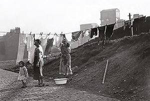
Driving these changes were the mine owning Joicey and Hedley families. The Hedleys owned mines in the upper section of the Twizell, around Craghead, South Moor and Quaking Houses, while the Joiceys owned Alma Pit, Twizell and Handenhold, as well as several collieries around Tanfield and Stanley.
When the industry that had changed the Twizell so much faded away, regeneration schemes cleared the waste and restored the area to peaceful woodland.
The scars of industry are not all gone, however. Four interpretation boards along the Craghead to Pelton Fell section of the burn explore this fascinating story, giving further information about the history and heritage of each site. Footpaths between the boards are marked by ‘waymarkers’ to keep you on the right path. A further eight interpretation boards mark heritage sites around the upper South Moor section of the burn (www.southmoorheritage.org.uk).